Sustainable Forest Management Solutions
GPS/GIS Mapping
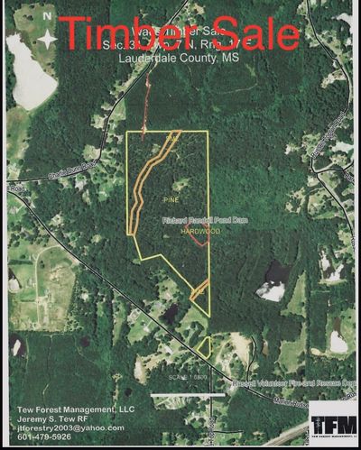
GPS and GIS technology greatly increases our ability to produce high quality, accurate maps for a variety of forestry applications. This technology allows us to produce accurate acreage for timber volume calculations which translates into more accurate valuation. Using the most up to date technology to create professional maps ensures that all forest management activities are more precise and efficient.